Winter storm and snowfall warnings blanket southern Alberta
-
Share on Facebook
-
Share on Twitter
- Copy Link
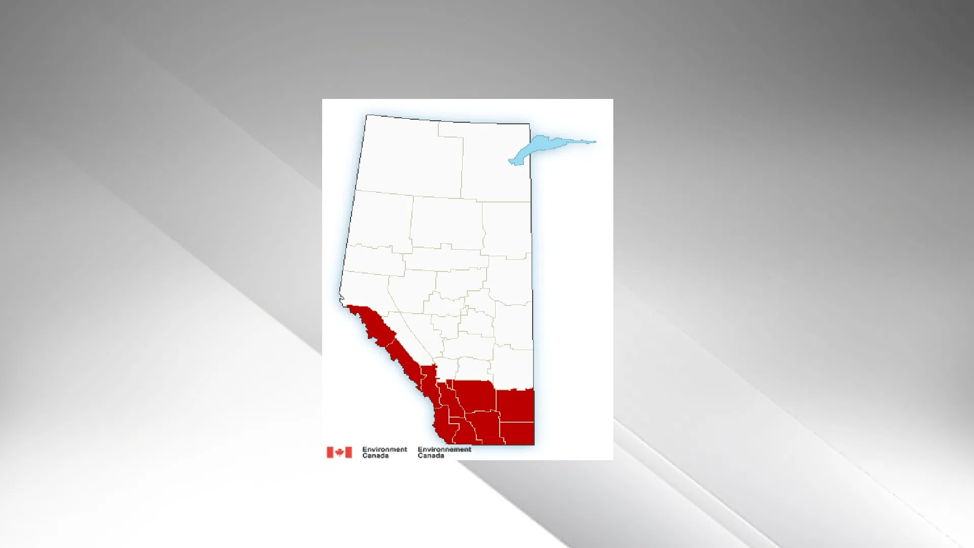
LETHBRIDGE – Old Man Winter is not done with southern Alberta yet. If you live anywhere between Crowsnest Pass and the Saskatchewan Border, north to Calgary and south to the U-S border, you’re under either a winter storm or snowfall warning today.
Environment Canada says a continuous stream of Pacific moisture from a low near the southern BC coast will continue to cause snow to fall across southern Alberta until Tuesday. Heavier accumulations of snow are expected to fall today and during the day on Monday
What the weather service calls a “potentially crippling” winter storm will hit the rocky mountains and foothills, packing up to a metre of snow. Areas that could be hardest hit include Crowsnest Pass, Pincher Creek, Cardston, Fort Macleod and Magrath.
In the Lethbridge – Taber – and Milk River region, up to 25 cm of snow will likely fall today and tonight, with winds tonight and tomorrow making visibility poor at times.
If you’re heading up to Calgary, or east towards Saskatchewan, the same warning applies.
AMA warns drivers that most roads in southwestern Alberta are either covered or partly covered with snow and ice, and visibility is fair to poor at times. Travel is not recommended and road closures in and near the mountains are likely. Visibility may be suddenly reduced at times in heavy snow. Poor weather conditions are likely to contribute to long-lasting transportation delays.


