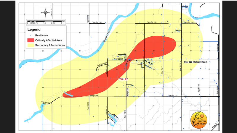
Cypress County mapping shows scope of storm’s destructive path
DUNMORE, AB – Mapping released by Cypress County shows wide-ranging damage from the July 18, 2022 wind storm stretching in a northwesterly direction all the way from Rattlesnake Lake nearly to Echo Dale Regional Park.
The location where Holsom Road meets with Range Road 73 is the heart of the most critically-affected area.
“What happened Monday was absolutely terrifying for many of our friends and family,” says county CAO Tarolyn Aaserud in a release. “We can see now that the impact was significant, but our community is coming together and will rebuild.”
The county used drone footage taken on July 19 to view the area and inform the mapping. More than 20 residences were in the hardest-hit area. Many buildings in that area were destroyed or severely damaged.


