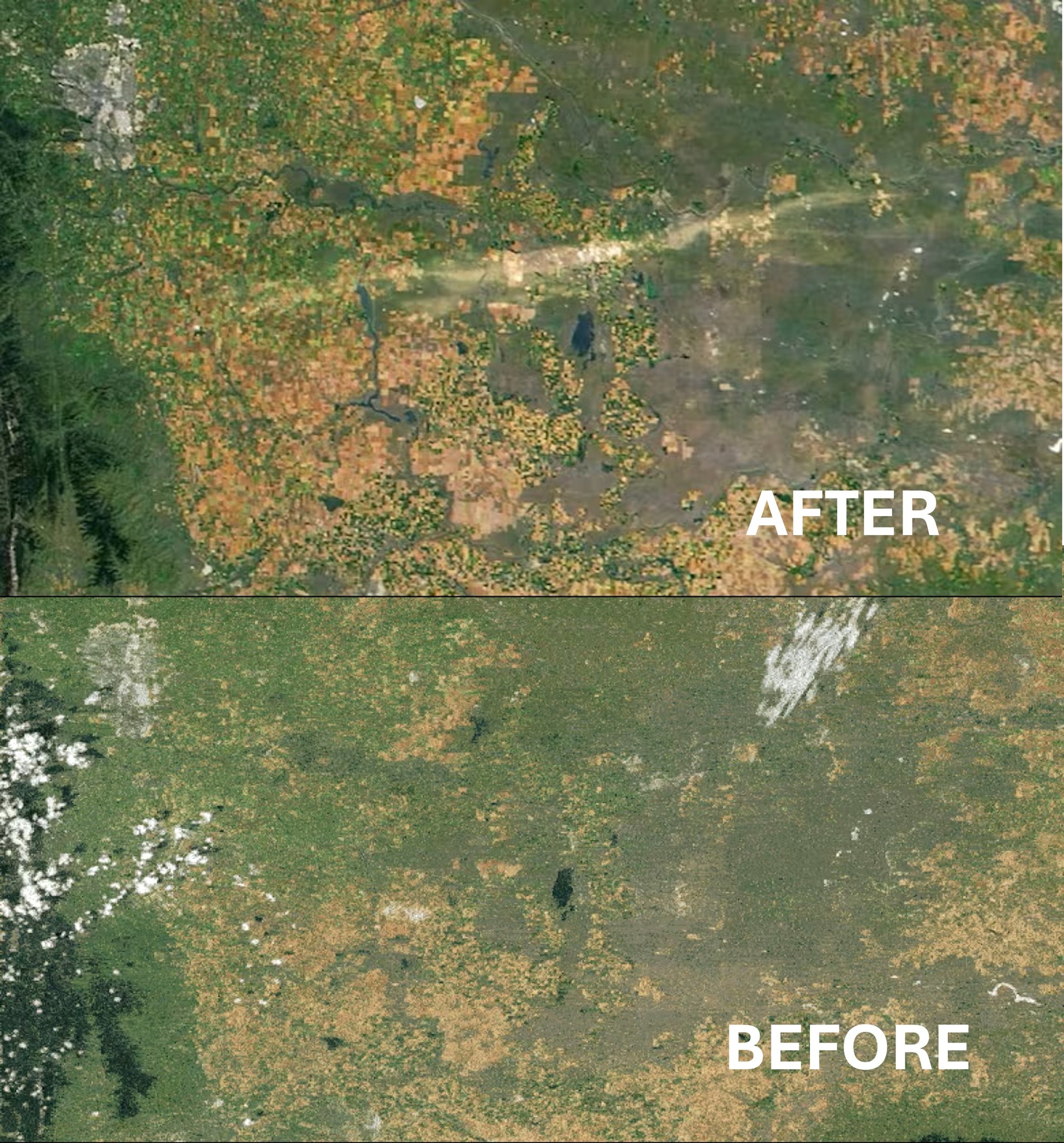
Images from NASA show that the damages from a recent hail storm in southern Alberta can be seen from space. (Photo: NASA)
Destructive path of August storm in southern Alberta visible from space
Sep 10, 2025 | 8:47 AM
-
Share on Facebook
-
Share on Bluesky
-
Share on X
- Copy Link
New images from NASA show that the aftermath of a powerful recent storm in the region can be seen from over 400 kilometres above.
The photos were shared online by Canadian astronaut Chris Hadfield.
The “before” photo was taken on August 19, 2025, and the “after” image was from the following day.
It shows a path of destruction that started near Vulcan, extending 200 kilometres to the east.