Tornado spotted near Nanton as central, northern Alberta braces for snow
-
Share on Facebook
-
Share on Bluesky
-
Share on X
- Copy Link
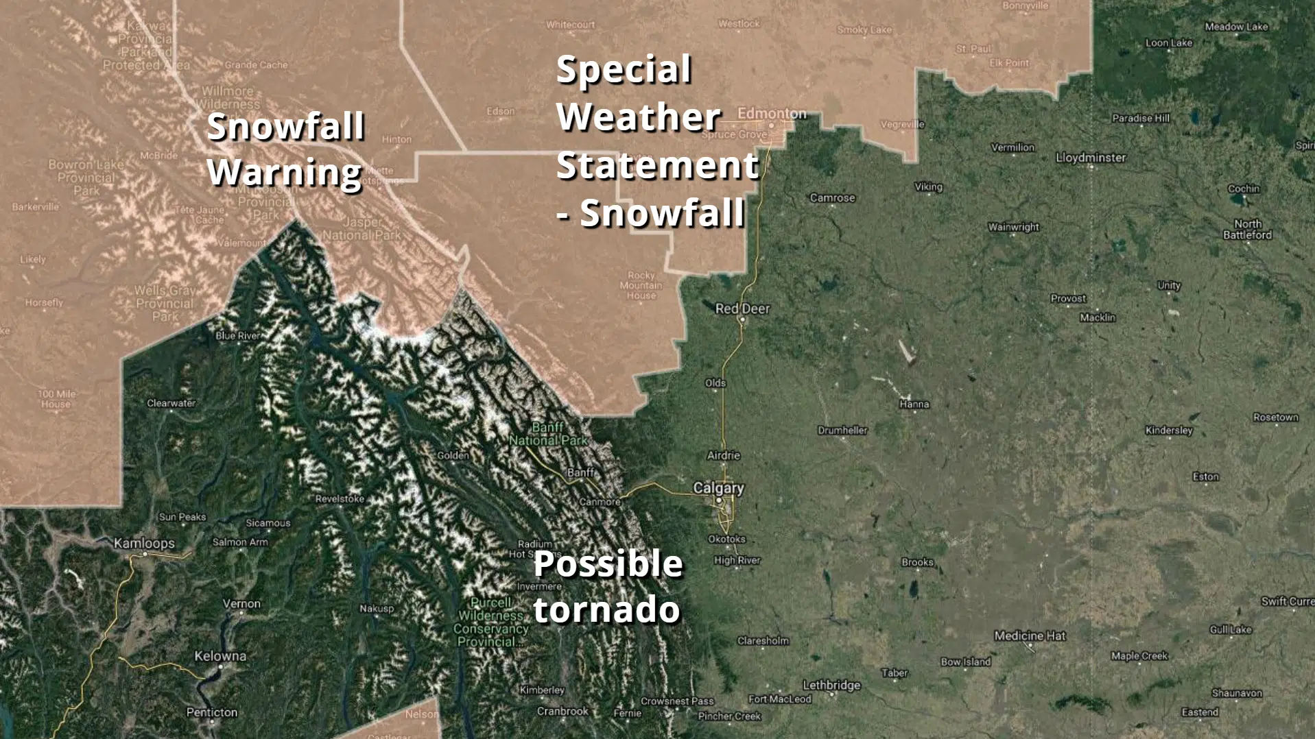
ALBERTA – While snow begins to fall in parts of central and northern Alberta, Environment Canada is looking into reports of a landspout tornado near Nanton.
During the afternoon of Tuesday, Sept. 11, a report from an observer 2 km west of Nanton described a tornado to the west, towards Pekisko. The weather service is asking people with pictures of the tornado or damage reports to send them in.
A landspout is a weak tornado that forms under a rapidly-growing thunderstorm. It is capable of blowing around objects, damaging roofs, and knocking over trees.
At the same time, a snowfall warning is in effect from Jasper north to Grande Prairie. Those areas could receive 10-15 cm of heavy, wet snow Wednesday, Sept. 12. The system bringing the snow will track south along the foothills, and then spread east towards Edmonton, which could get 3-8 cm.